






NB: The Moroccan Ministry of Energy Transition and Sustainable Development recently granted all these permits to the company as part of the national program for the reassignment of mining permits and licenses. The total area covers 96 square kilometers, of which 16 correspond to the licenses.
Efficiency and Excellence at Every Stage of the Process
Innovation for the Mining Future
We are characterized by our focus on efficiency, safety, and compliance with the highest environmental standards.
Akrima
Marrakech-Safi Region
Geology
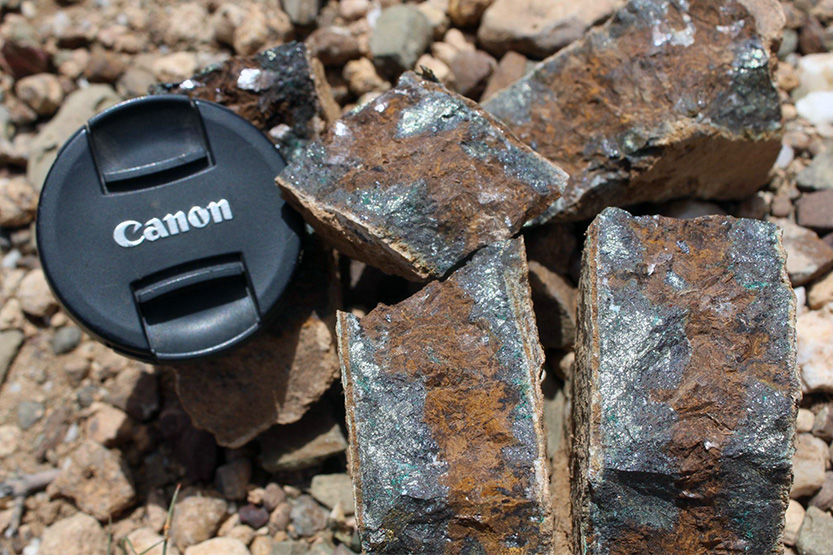
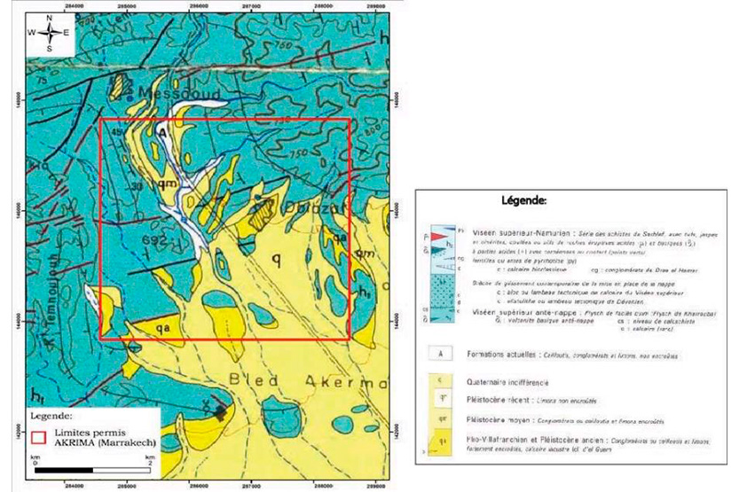
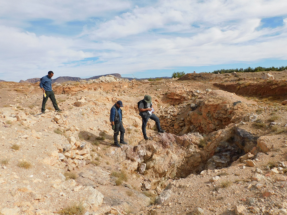
The study area is located in the province of Jebilet, a geologically rich and promising area for copper mineralization. This mineralization is controlled by structures such as faults and shear zones, and is manifested by quartz and calcite veins.
Copper (in the form of malachite, calcopyrite, etc.) is mainly found in volcanic-sedimentary and schistose rocks. These characteristics make this area a privileged target for mining exploration, particularly for base metals.
Mineralisation
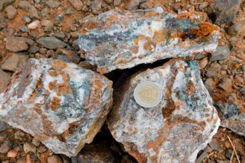
Three main structures were identified, all consistent with a VMS-type deposit model (volcanogenically-derived massive sulfide):
– Structure 1: Orientation block East-West, rich in copper (malachite, calcopirite, bornite) in a quartz matrix and ankerite.
– Structure 2: Oxidized quartz vein with north-south orientation, containing dispersed malachite, resulting from secondary oxidation processes.
– Structure 3: Fault filled with calcite, which acts as a tectonic conveyor, having favored the circulation of mineralizing fluids.
Exploration
The geophysical study revealed several structural anomalies interpreted as veins or intrusive bodies with high mineral potential. The analyzed profiles show areas of fractures, thickening, and variations in the geophysical field, indicating the probable presence of mineral-rich veins. Three blocks of anomalies stand out for their importance, confirming the great potential of the area for future exploration and targeted drilling operations.
Ighoud
Marrakech-Safi Region
Geology
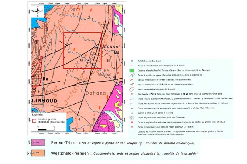
The Ighoud permit is located in the complex and rich geological region of the Western Jbilet. This area is composed of ancient volcanic sedimentary and metamorphic formations, crossed by veins and quartz intrusions. It contains several mineralized structures of copper, lead, zinc, and calcite, associated with hydrothermal activity. This geological context gives the permit an interesting potential for vein and hydrothermal mineralization.
Mineralisation
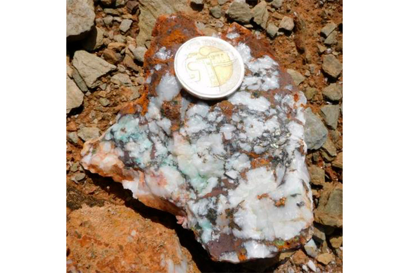
Two quartz veins, oriented N150 and embedded in schist, show significant mineralization of copper sulfides (calcopirit and malaquita). They were sampled with a thickness of 30 cm and an extension of 20 meters.
The analysis of these samples is crucial: it will allow determining the copper content, the associated elements, and the spatial distribution of mineralization, thus evaluating the mining potential of the region.
Exploration
The geophysical profile is divided into three main segments: the first (0-50 m) presents a marked drop in signal and reveals a mineralized zone with mineral veins and possible parallel structures; the second (50-170 m) presents a stable and regular structure; the third, particularly between 170 and 250 m, is characterized by a sudden change in signal, indicating a contact zone or the presence of a mineral deposit, with rock alterations due to intrusions that allow the modeling of rich zones. All the profile reveals numerous promising parallel structures, making sectors 1F200 and 2F200 priority targets for exploration.
Tiouiyine
Draa Tafilalt Region
Geology
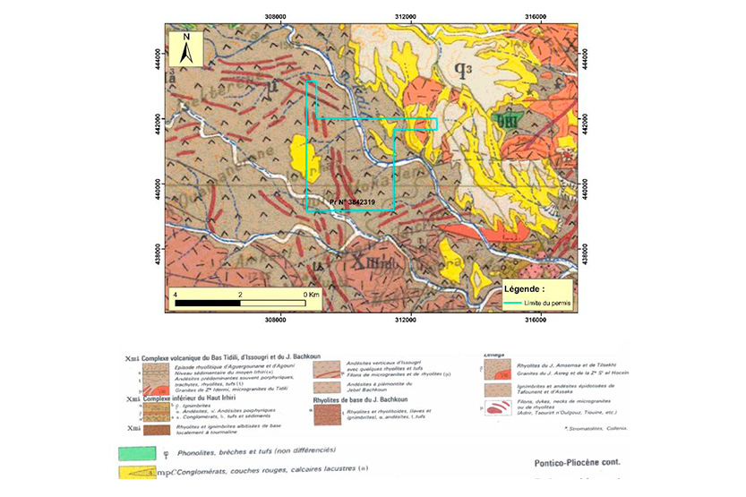
The area presents a complex geological context, conducive to mineralization. It is characterized by:
- Diversity of ancient sedimentary and volcanic-sedimentary rocks such as andesites and riolites, and microgranite vein boulders.
Numerous tectonic structures (faults, folds) that channeled mineral-forming fluids. - A transitional position between the Atlas Mountains and the southern plains of Morocco, accentuating this complexity.
- An erratic geomorphology that favors erosion and the exposure of potentially mineralized rocks.
- This set of characteristics creates an environment conducive to the formation of deposits.
Mineralisation
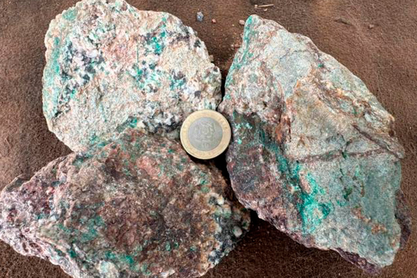
Malachite, a copper mineral, was discovered northwest of the study area. It is associated with hydrothermal alteration in volcanic-sedimentary rocks and quartz veins.
Its presence on the surface indicates an oxidized zone, resulting from the alteration of deeper primary sulfides (such as calcopyrite). This observation suggests the existence of a deeply mineralized system, controlled by fractures with an orientation from EO to NE-SO.
Exploration
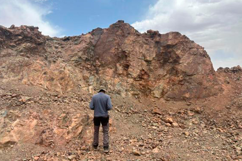
The analysis of regional geological data guided a specific exploration campaign that yielded concrete and promising results. This campaign enabled:
- The identification and location of promising copper veins.
- Mapping of significant areas of hydrothermal alteration.
- The census of several barite indices
This methodical approach thus validated the mineral potential of the sector for this type of mineralization.
Icht
Souss Massa Region
Geology
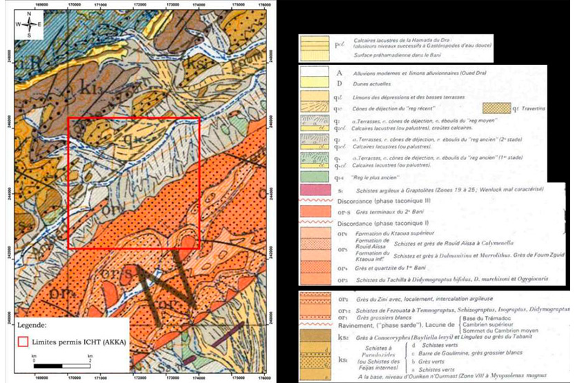
The Icht permit, located in the southern Antiatlas, is located in an area with high metalogenic potential.
Exploration work (mapping and sampling) has revealed mineralized structures (oriented east-west and north-south) with copper, lead and silver contents. These mineralizations, associated with hydrothermal alteration, are characteristic of the vein systems of the Antiatlas. Therefore, the permit is considered a promising geological environment for the discovery of deposits of economic interest.
Mineralisation
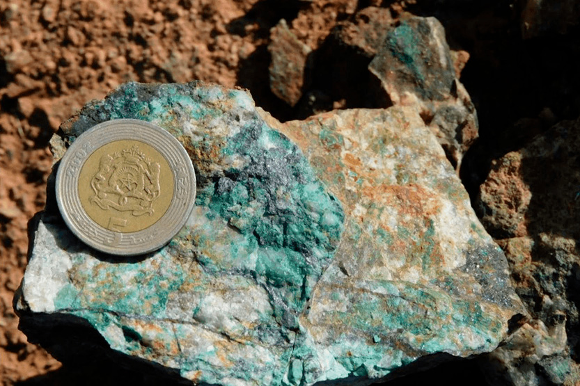
An oxidized quartz vein, with a thickness ranging from 1 to 3 meters and extending over more than 200 meters. A vein of 200 meters has been identified. This vein, oriented primarily to N110, exhibits scattered indications of minerals such as malachite, azurite, calcopirite, and galena. These oxidation minerals suggest significant mineralization activity in the past. The vein was also the scene of ancient mining operations, as evidenced by the presence of a 15-meter-deep well and several trenches, highlighting the historical importance of this structure for the extraction of valuable minerals.
Exploration
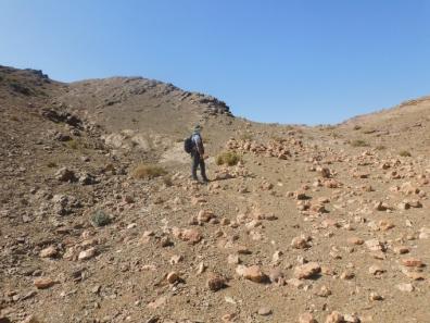
The exploration work carried out in the Icht permit, which included sampling of eleven samples from various geological structures and the excavation of three trenches, confirmed the presence of copper mineralization (malachite and calcopyrite) in vein Cuarzo 1.
Foum El Hicn
Souss Massa Region
Geology
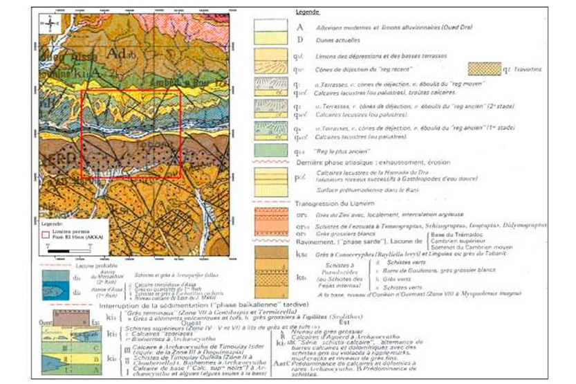
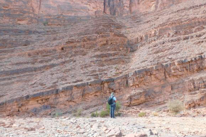
The geological formations observed in the study area include metamorphic limestones, as well as oxidized dolomite limestones. These layers are deposited discordantly on a base composed of alternating black and sandy lutites. As for the mining exploration in the Foum El Hicn permit, it is essential to consider these different geological formations.
Mineralisation
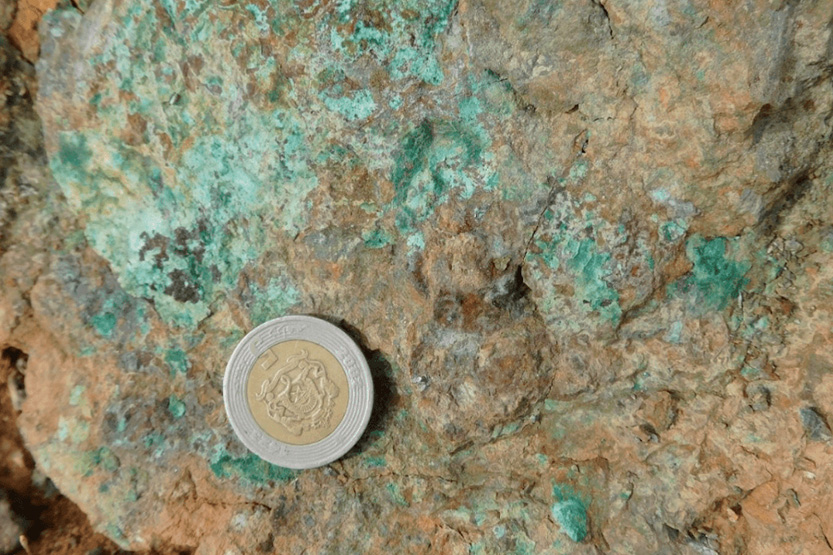
The sampling focused on several revealing mineralized structures. A vein of calcite and quartz with potential mineralization was collected, as well as a sample at the strategic contact between black schist and dolomitic limestones for the study of geological interactions. Several mineralized quartz veins were sampled, revealing sulfide mineralization, malachite and calcopyrite, including a promising association of silver-copper mineralization. A particularly significant sample showed a high concentration of malachite and calcopyrite, confirming the presence of substantial mineralization in the area.
Exploration
The exploration campaign began with the collection and compilation of baseline data, including existing maps and geological reports. It continued with a detailed field geological mapping, focusing on outcrop observation and contact zone studies. The selective sampling resulted in the collection of five representative samples of specific formations: a calcite vein with quartz, a contact between schists and limestones, and calcite veins with malachite, calcopyrite, and sulfides. These samples will undergo extensive laboratory analysis (mineralogical and geochemical) to determine metal concentrations. In parallel, exploration trenches will be excavated to expose structures at depth, all guided by continuous environmental assessment to ensure sustainable practices and minimize ecological impact.
Tizounine
Souss Massa Region
Geology
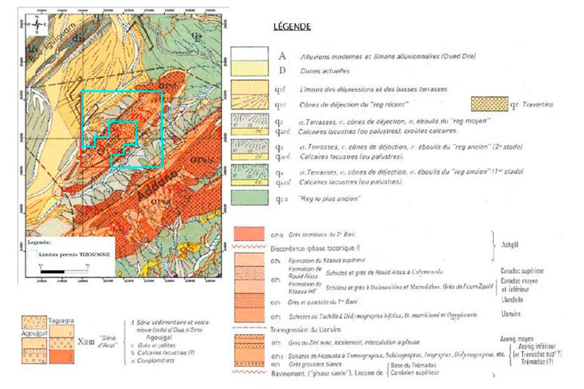
The study permit is located in Jbel Guilez, a massif belonging to the Hercinic chain of the Moroccan Antiatlas. This region is recognized for its metalogenic potential, confirmed by the presence of polymetallic indices. The area is characterized by the mineralization of lead and copper, materialized by quartz veins and impregnations in the sedimentary rocks of the Ktaoua formation.
Mineralisation
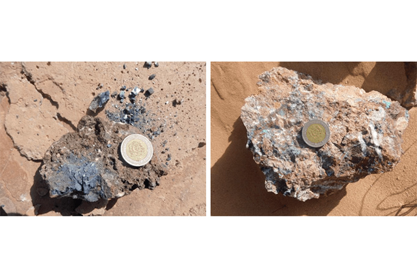
Results of sampling and mineralized formations:
– Quartz with iron oxides and traces of lead (Pb): A series of samples revealed lead inclusions in a quartz matrix and iron oxide. This association is consistent with the polymetallic mineralization of VMS systems, where lead is commonly found alongside copper and zinc.
– Quartz with iron oxides and traces of malachite: Samples from oxidized zones show the presence of malachite, a secondary copper carbonate. This mineralization reflects processes of oxidation and supergene enrichment, typically superimposed on the primary mineralization of the VMS type.
– Quartz, iron oxides and traces of lead and silver: Finally, some formations reveal the coexistence of quartz, iron oxides and traces of lead, confirming the mineralogical heterogeneity and the geochemical complexity of the explored area.
Exploration
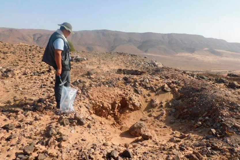
The prospecting work carried out in the Tizounine permit revealed the presence of mineralized veins, which were the subject of systematic reconnaissance and delimitation operations. These interventions combined light (razing, clearing) and heavy (reconnaissance trenches, exploitation works) excavation techniques, which made it possible to pinpoint the geometric continuity and the
Spatial distribution of the identified mineralized structures. NS direction (average power 40com and quartz veins). Lead indices.
Akka
Souss Massa Region
Geology
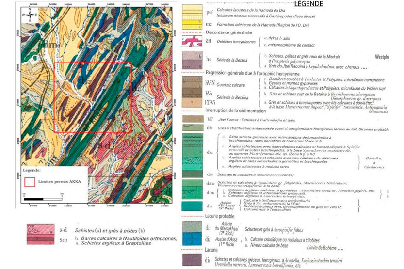
The study area, located in the western region of the Antiatlas, near the city of Akka, features a remarkable hydrothermal mineralization system. This mineralization is manifested through a network of calcite veins, whose morphology and geological context provide valuable clues about the conditions of its formation.
Mineralisation
The geological formations of the study area include:
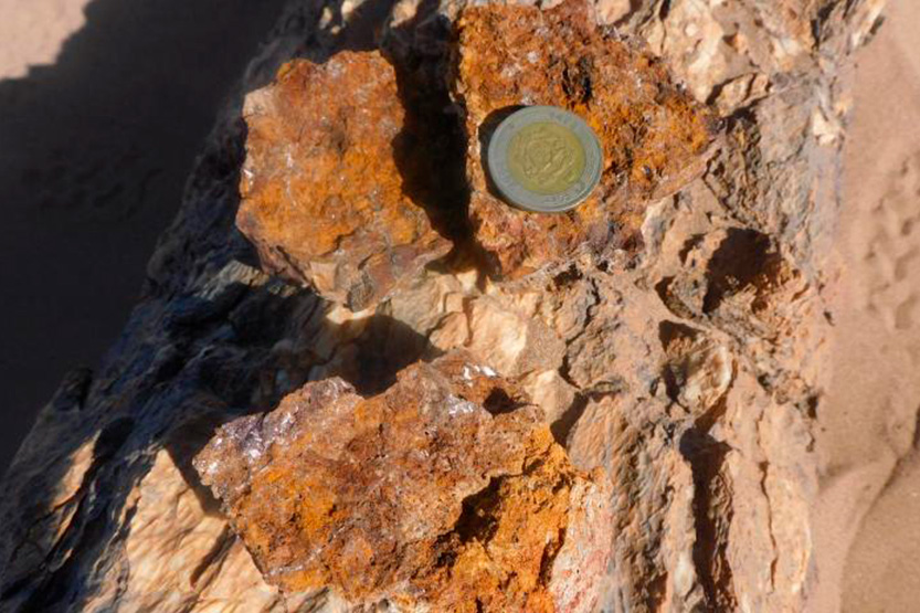
– Highly deformed limestone cut by calcite veins;
– Highly deformed limestone cut by calcite veins and rich in iron oxide.
– Highly deformed limestone cut by calcite veins, rich in iron oxide and containing fossils; Quartz veins are intercalated within sandstone and shale formations; this structural environment is a known control for lead mineralization.
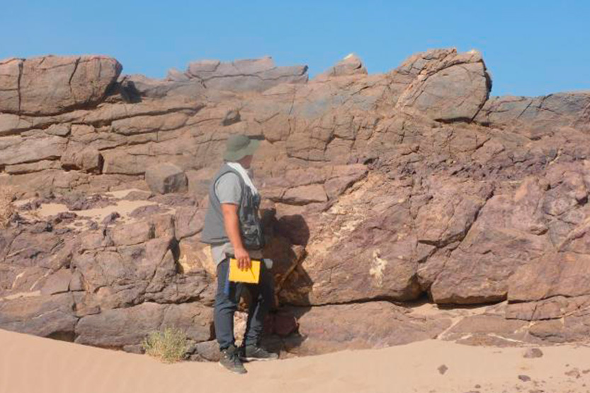
– Quartz veins with lead spots that run parallel to the formation; quartz veins embedded in sandstone formations containing lumachels; oxidized quartz veins within sandstone and shale formations.
Exploration
The exploration of the Akka permit was structured around a detailed geological mapping, which served as the methodological basis to guide the prospecting and sampling campaigns. This approach allowed the location and identification of several quartz veins with significant evidence of lead mineralization.
Ain Zohra
Oujda Region
Geology
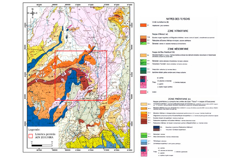
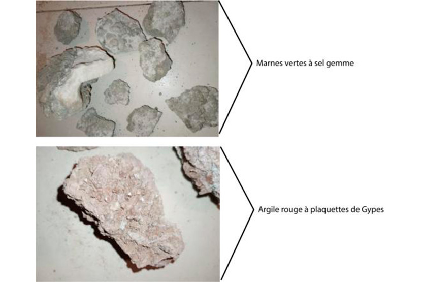
The study area presents a diversity of geological formations characteristic of arid to semi-arid environments. They mainly include evaporites (such as gypsum and halite), formed by precipitation, and red-yellow clayish clays, rich in gypsum. These formations, with distinctive colors (red, yellowish, green), are the result of evaporation processes, chemical alteration, and erosion, and play a fundamental role in the composition of the local geological landscape.
Mineralisation
The sedimentary sequence described is characteristic of an evaporite-type basin, formed under arid to semi-arid climatic conditions. The lithological assemblage, along with the mention of a presence of lithium, reveals a controlled depositional environment and potential economic value for critical elements.
Exploration
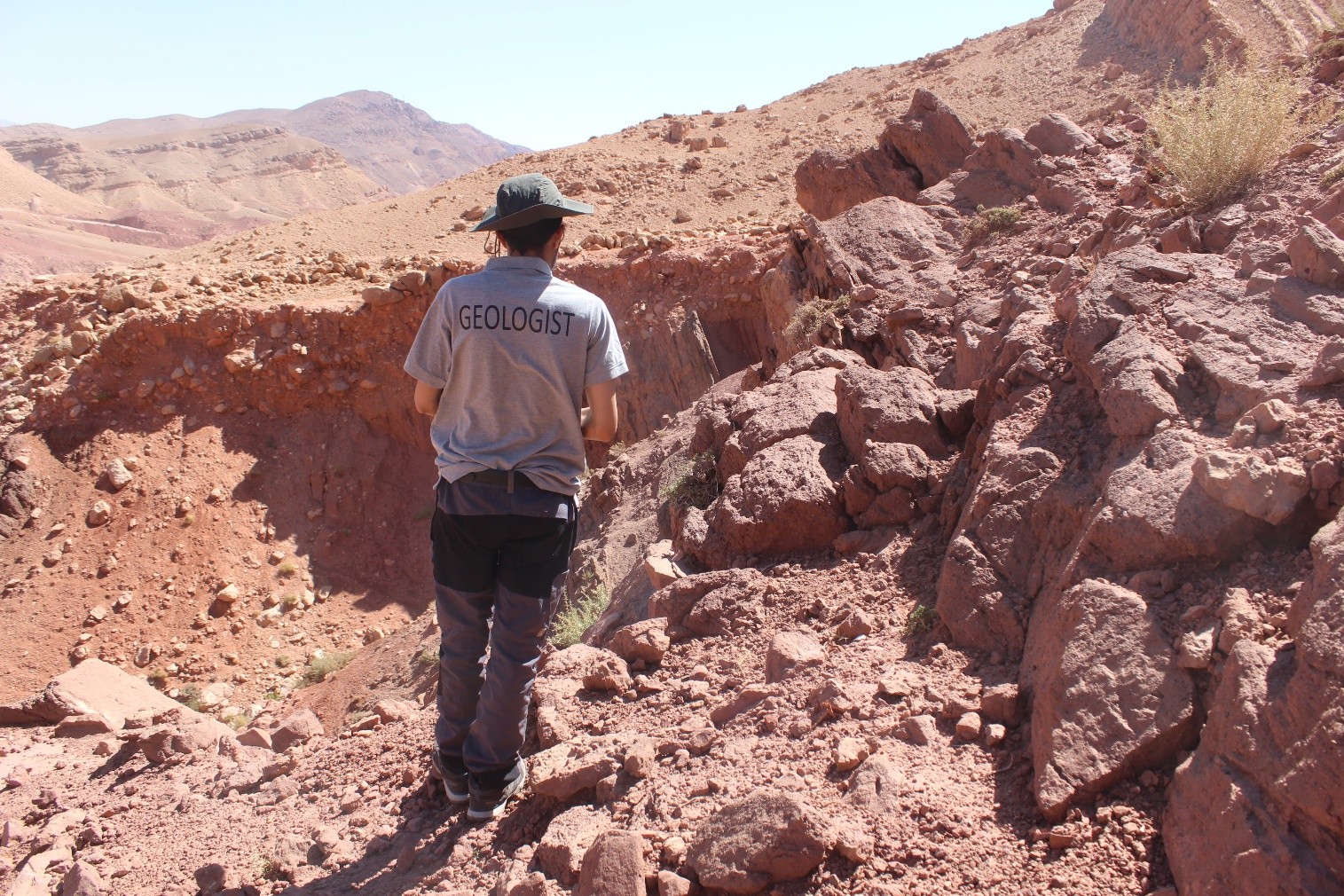
The exploration has focused specifically on two geological formations of economic interest: saline clay formations and shale deposits. This methodology ensures a reliable assessment of the composition and mineral potential of the materials sampled.
Guercif
Oujda Region
Geology
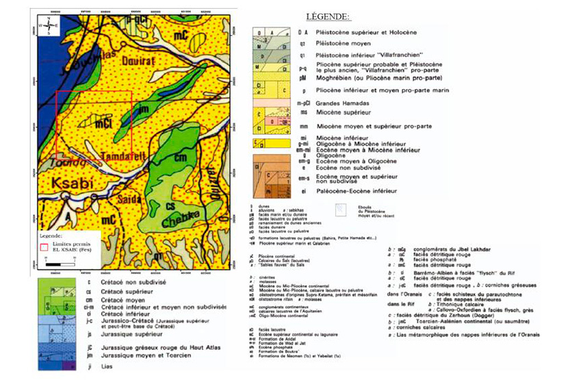
The Guercif basin constitutes the eastern part of the Southern Rif Corridor, a large depression located between the intracontinental domain of the Moroccan Meseta to the south and the Rif mountain range to the north. The basin is filled with a thick sequence (several kilometers) of sediments of Neogene to Quaternary age (from -23 million years). These sediments are mainly:
- Conglomerates (piedras pudines), witnesses to the rapid erosion of the nascent Rif chain.
- Arenaceous and clayey materials deposited in alluvial, lacustrine and deltaic environments.
- Limestones and evaporites (limestone), indicative of episodes of confinement and desiccation.
Mineralisation
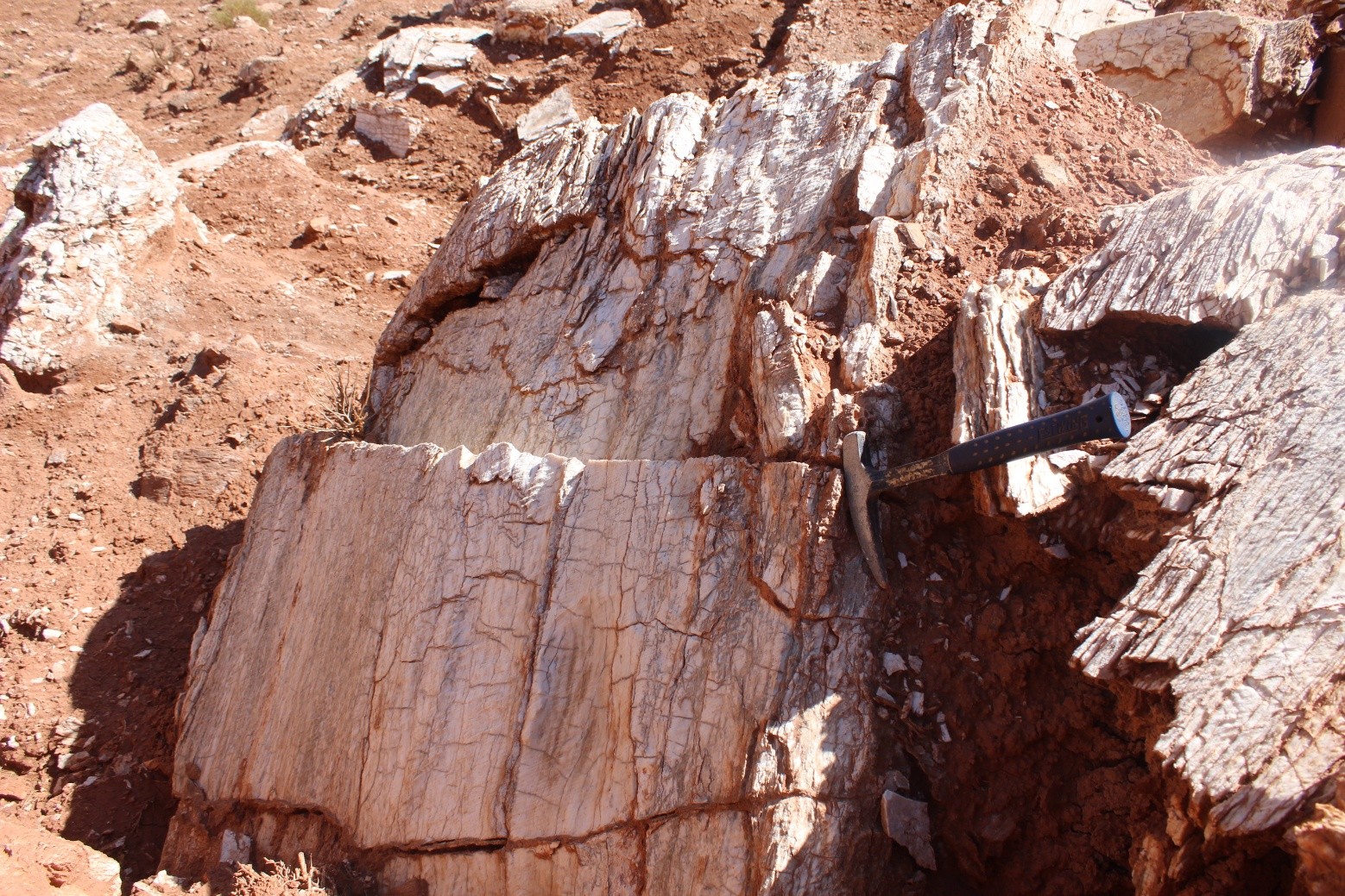
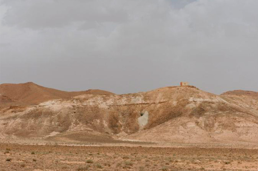
The Triassic massif of the Uchda region, composed of limestone and salt, is very susceptible to dissolution. This causes intense karst activity, which leads to extensive relief evolution, landslides, and the sudden formation of large valleys and sinkholes. This process creates chaotic landscapes where various hillside collapses (landslides, rock falls) occur simultaneously. At the base of these slopes, alluvial arcillio-saline cones are formed, identified as potential traps for the enrichment of lithium derived from the weathering of the salt rocks.
Exploration
The exploration began with a preliminary geological and structural mapping to identify the main lithological units and structures (faults, folds) that influence mineralization. Based on this, a detailed field program was planned, defining the priority objectives and the research methods.
Ain Zelfoune
Fez-Mequinez Region
Exploration
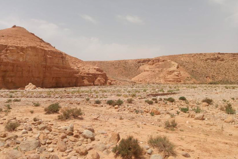
The exploration campaign carried out in the area has identified and located several sedimentary formations of interest. Among them, special attention has been paid to the red salt clay formations and the mudstones. These lithological units, the detailed characterization of which is currently underway, are of great interest due to their potential in industrial minerals and their role in understanding the geological evolution of the sedimentary basin.
The Ksabi
Fez-Mequinez Region
Exploration
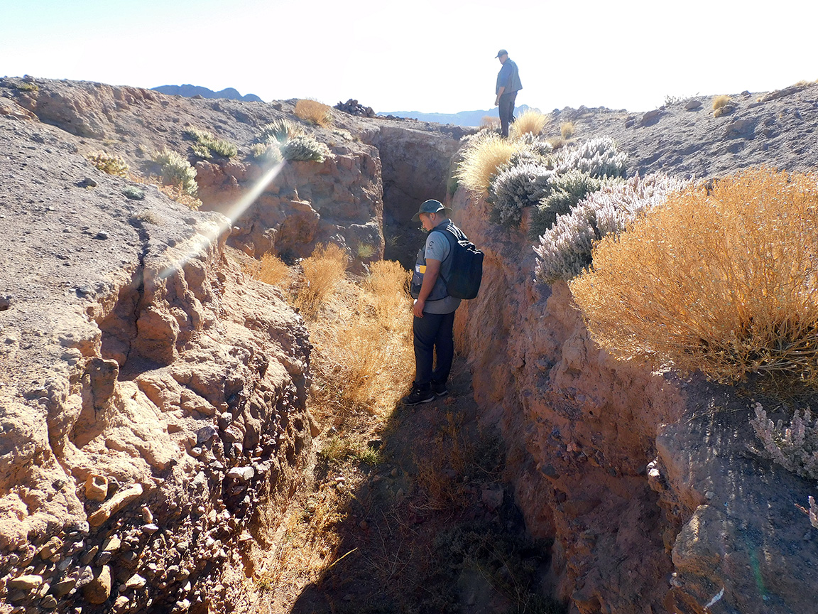
The exploration campaign carried out in the area has identified and located several sedimentary formations of interest. Among them, special attention has been paid to the red salt clay formations and the mudstones. These lithological units, the detailed characterization of which is currently underway, are of great interest due to their potential in industrial minerals and their role in understanding the geological evolution of the sedimentary basin.
Qelaat M´gouna
Draa Tafilalt Region
Geology
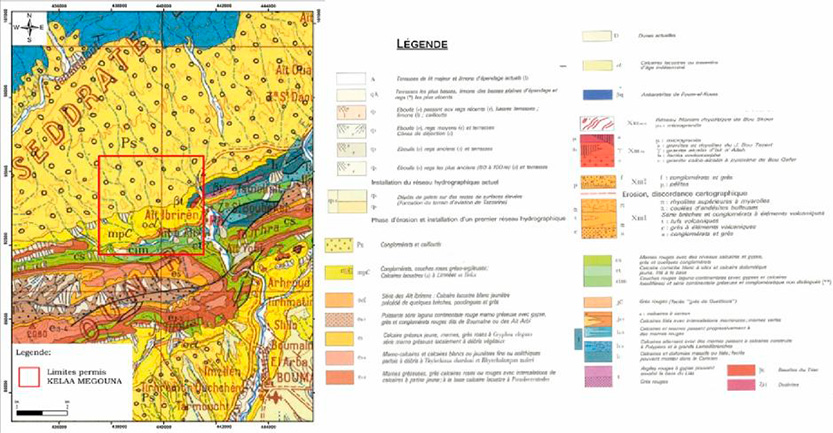
The region of Qelaat M'Gouna, in the eastern Cordillera of the Antiatlas, presents a complex geological context, marked by a precambrian internal structure. Its geological history is characterized by two main cycles: a first cycle that includes acid calcic magmatism and deposition in a
The arcuate basin, followed by a second cycle of volcanic and plutonic formations. This evolution, influenced by phases of subduction, rifting, and pan-African deformation, shaped a volcanic sedimentary basement intruded by granites and gabbros. This geological complexity is fundamental to understanding the regional dynamics and mineral resources potential.
Mineralisation
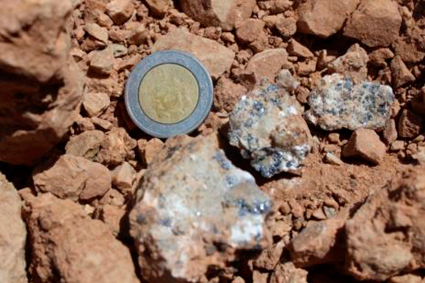
The exploration has revealed the presence of various geological formations, including yellowish limestones with slight dolomitization, reddish clays with layers of gypsum and black flakes rich in iron oxides. These formations show promising signs of mineralization, especially of lead and silver.
Exploration
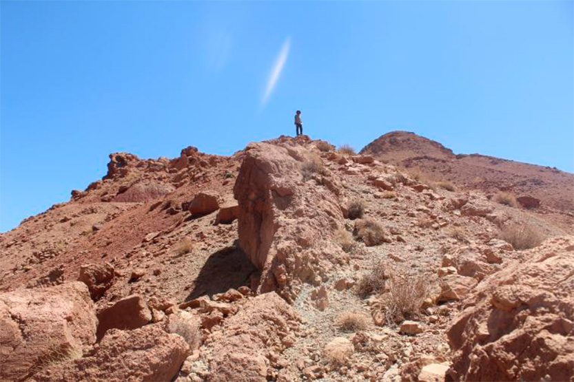
The exploration campaign carried out in the permit Qelaat M´gouna This resulted in the collection of representative samples, taken using a grid that encompassed around ten points of geological interest. This sampling strategy systematically investigated three main lithological units:
– Yellowish limestones with low dolomite content, which provide key indicators of the mineralogical composition of the basin.
– Red clay formations crossed by layers of gypsum, testimony to distinctive diagenetic and sedimentary processes.
– Black pellets with a high concentration of iron oxides, the origin and genesis of which are of great interest for the modeling of regional mineralizing systems.
Five Zagora Exploration Permits:
4 Permits and 1 License
Draa Tafilalt Region
Geology
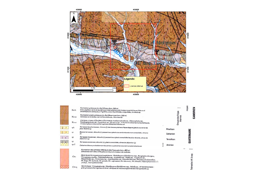
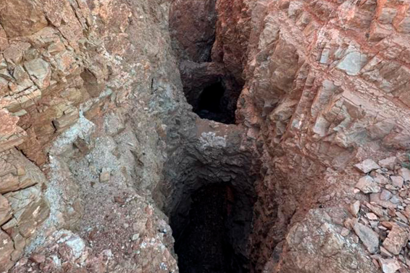
The study area is located in the southeastern part of Bou Azzer interior (Antiatlas Central), more precisely at the level of its paleozoic cover. Locally, the sector is characterized by sandstone-shale to sandstone-limestone formations of the Adoudonian to Middle Cambrian age. From a structural point of view, the perimeter is affected by a system of multidirectional faults, mainly oriented east-west, northwest-southeast and northeast-southwest.
Mineralisation
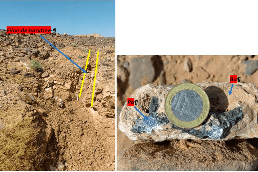
A favorable geological environment with sandstone and limestone host rocks contains several mineralized structures in the four permits. These consist of veins, layers, and barite veins of high quality containing lead aggregates, demonstrating the potential for substantial barite mineralization.
Exploration
The exploration of the Zagora permits was carried out using an integrated methodology based on extensive bibliographic research and direct field observation for geological interpretation. This strategic approach enabled the detailed mapping of several mineralized deposits (mainly barite and lead). The correlation between the objectives identified during the preliminary phase and field observations confirms the mineralized potential of the district, positioning barite as a priority economic target that justifies the continuation of geological investigations.
Bourbia
Draa Tafilalt Region
Geology
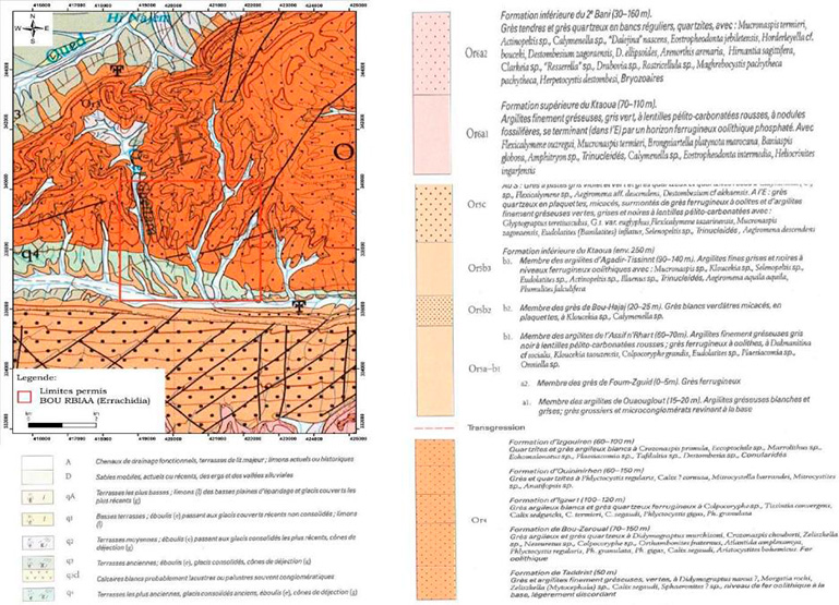
The study area is located in the Anti-atlas, a vast anticline structure with an ENE-OSW orientation. The permit presents a complete geological sequence that spans formations from the Late Precambrian to the Cambrian, with superimposed Quaternary deposits. The precambrian units (group PIII), composed of ignimbrites, andesites, traquites, and volcanic-tectonic sediments, represent a key record of the regional geological history.
The study of these formations is of fundamental importance for understanding the geodynamic evolution of the region, assessing its mineral resource potential and identifying geological hazards, thus enabling an optimized management of natural resources.
Mineralisation
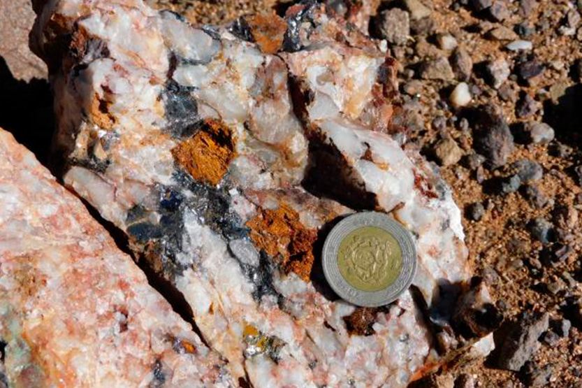
Arenaceous ferruginous quartz: These formations are characterized by a high content of quartz and iron oxides, which indicates conditions Iron-rich deposits.
Quartz associated with quartzite containing traces of iron oxides: The samples show an intimate association between quartz and quartzite, with traces of iron oxides that suggest secondary mineralization.
Yellowish marigolds: It is identified by its yellowish hue due to clay and iron inclusions, which suggests mixed depositional environments.
Iron-rich soils: These lands have a high concentration of ferruginous minerals, indicating a significant source of iron.
Exploration
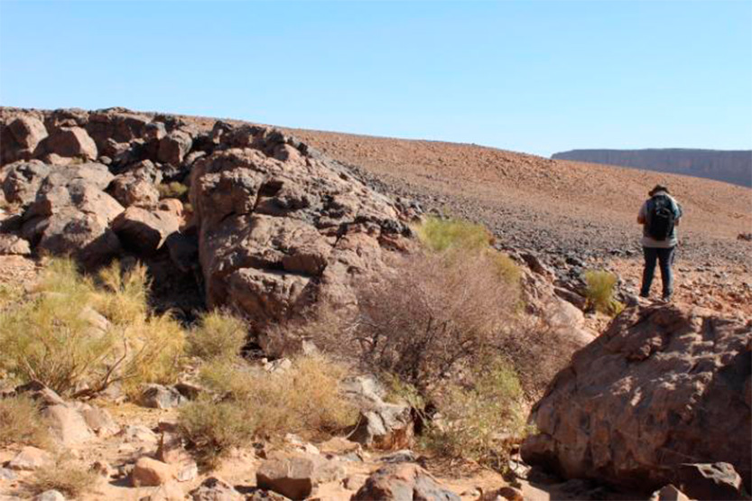
The exploration campaign in the BOURBIAA permit began with a detailed mapping that revealed a remarkable lithological diversity, dominated by quartz sands and quartzites. Eleven representative samples of these formations with varied mineralogical potential were taken. For the next phase, it is planned to excavate trenches to systematically investigate the target areas, including in particular the quartz sands rich in iron oxides, ferruginous terrains, margassian limestones, and quartz veins.
Boughrar
Draa Tafilalt Region
Geology
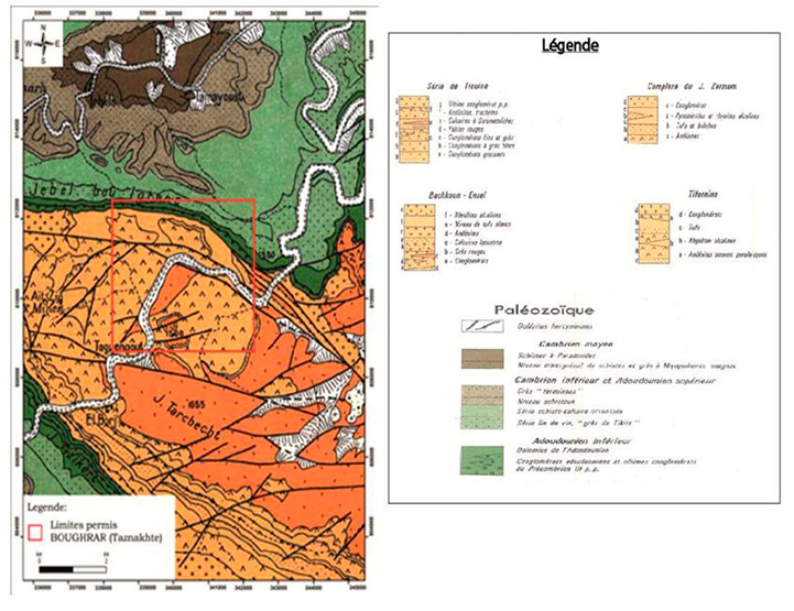
The property Boughrar, located in the precambrian enclave of Tifernine, presents a geological environment dominated by volcanic rocks of the Ouarzazate Group (Precambrian III). The mineralization of copper and iron-manganese is concentrated in the central and southern areas, associated with porphyric andandesites (Boughrar Formation) and massive rhyolites (Wayt Az-Zig Formation). The northern area, composed of sedimentary clastic rocks of the Tata Group (Infracambrian-Cambrian), remains barren.
The property is intersected by mafic and felsic dikes, as well as quartz veins, generally without mineralization at the surface. The data suggest a structural bulge with an NE direction.
Mineralisation
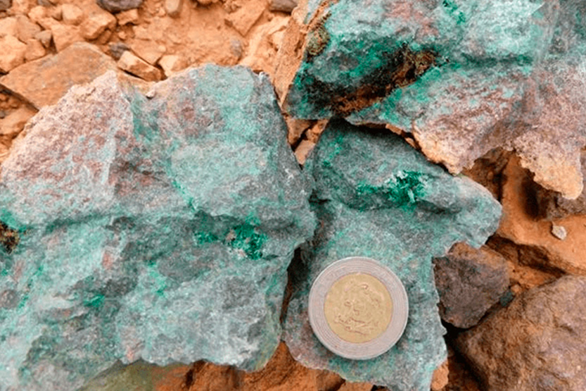
The Boughrar license is characterized by volcanic formations, primarily rhyolites, that host a copper and silver deposit. The mineralization, concentrated in the southeastern sector of the license, is associated with steep inclined structures, with an east-west direction to northeast. These include igneous dikes of diverse composition, often bordered by mineralized veins, and, subordinately, independent veins from the dikes.
Exploration
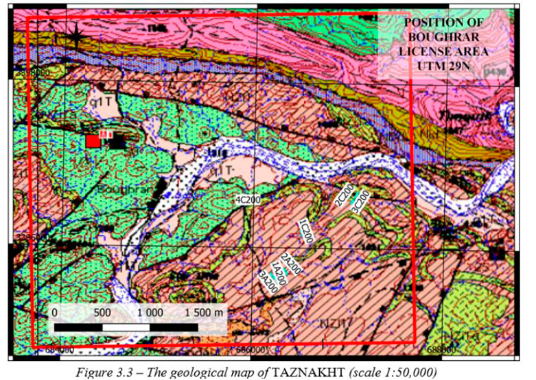
A geophysical campaign conducted in several areas of the permit included the acquisition of seven profiles with 600 MHz antennas, which allowed the identification of possible copper veins.
The interpretation distinguished mineralized veins from sterile rock, confirmed the geometry of a dike intersected by the 1C200 profile, and revealed several promising secondary veins in the 2A200, 1A200, and 3A200 profiles. The integration of the data into a GIS provided a precise model of the direction and magnitude of the main mineral body, as well as three new similar structures with proven potential.
Tikirt
Draa Tafilalt Region
Geology
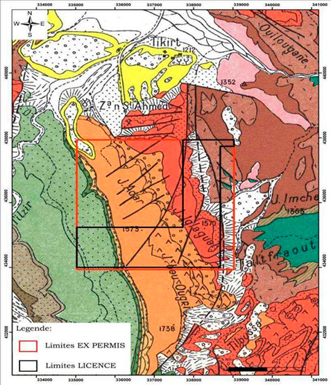
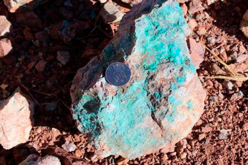
The geological environment of the Ouarzazate concession is characterized by the presence of mafic dikes and intrusive igneous intrusions that traverse a complex metamorphic basement. These geological formations are typical of the region and are often associated with fractures in the host rock, which favors mineralization. The dikes, generally oriented east-west, exhibit signs of copper with gentle veining and manganese deposits in the southern part of the concession, suggesting considerable mineral potential. The Ouarzazate concession is characterized by great geological diversity, reflecting a solid exploration and mining potential. Field work conducted in the region includes detailed geological mapping and selective sampling of rocks of various facies.
Mineralisation
The lithological units exposed in this area consist of volcanic, volcano-sedimentary and sedimentary formations, which span an age range from the Neoproterozoic to the Quaternary. This geological diversity gives the region a high mineralogical potential, illustrated by the presence of several deposits and occurrences of manganese (Mn), iron (Fe) and copper (Cu). The mineralization is mainly of the VMS type (Massive Volcanic Sulfide), a style recognized worldwide for its economic importance, characterized by metal concentrations formed in association with volcanic activity and hydrothermal environments. Given this lithological diversity and the favorable context, the mineral content is… considered significant, reinforcing the interest of this area for exploration in the form
Exploration
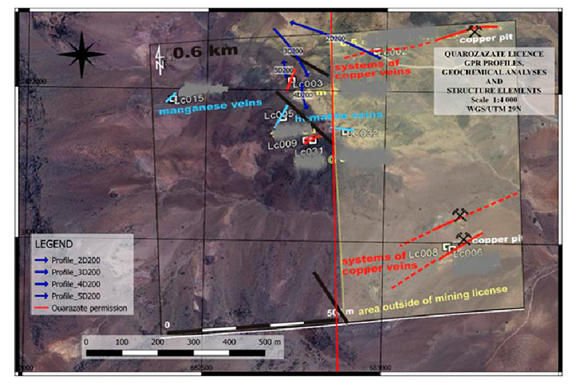
A geophysical campaign conducted within the permit allowed the acquisition of profiles perpendicular to the likely mineralization axes, revealing several significant structures. The 2D200 profile, which intersects a fault and a copper vein, identified seven structures organized into three blocks: one (10-25 m) interpreted as a fault, and two others (40-200 m and 205-265 m) indicating alteration associated with intrusive materials. These anomalies show good correlation with the copper outcrops, a consistency also observed in the 2D200 and 5D200 profiles; the latter reveals deep tectonic modifications. Finally, the 4D200 profile highlighted distinctive anomalies in the intrusive contacts at 5 and 50 meters.
Tinzoulin
Draa Tafilalt Region
Geology
The study area belongs geologically to the southeastern part of the Bou Azzer inlier, exactly on the Paleozoic cover. This inlier is part of the Central Anti-Atlas. The Bou Azzer inlier rises in the form of an ophiolite complex and a series of arches at the height of the main fault of the Central Anti-Atlas. Locally, the perimeter of the permits is occupied by the Paleozoic cover facies, manifested by terrains dating from the Adoudonian to the Middle Cambrian. The predominant lithology in the study area is presented in sandstone-shale to sandstone-limestone formations.
Mineralisation
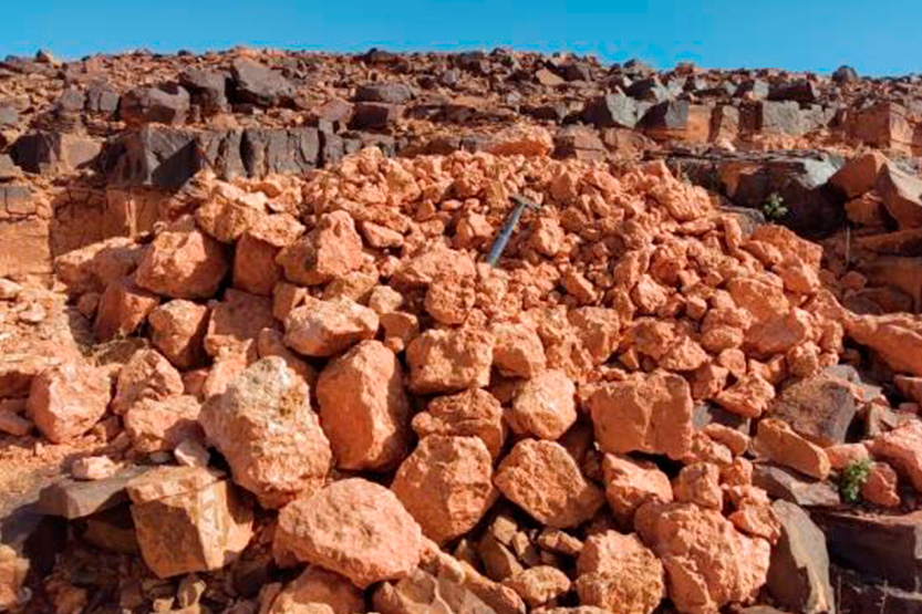
Within the license, three barite structures were mapped as veins, long veins, and stratiform strata. Two new barite veins were also identified, in addition to a large carbonate outcrop cut by quartz veins.
Exploration
The exploration of the Tinzouline license was guided by a methodical approach, starting with the creation of a predictive map of geological indices before the start of field work. This planning allowed the identification and accurate documentation of numerous mineral deposits, including an extensive system of veins, well-individualized lamellae, and several stratigraphic barite levels.
The consistency between the objectives defined in the preparatory phase and the field discoveries confirm the area’s mineralizing potential, establishing barite as a promising economic resource that motivates the continuation of exploration programs.